MetaOpt Metering

Metering by walking agents of Public Utilities companies

Optimising walking handheld meter readings

MetaOpt provides route optimisation solutions for public utilities. We offer a comprehensive software service of route planning tools for walking handheld meter reading route creation to minimize cost and workload.
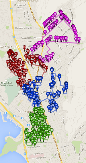
Balanced walking routes

  • Balanced routes.
  • Meter reading cycle days.
  • Solutions based on total route time desired.
  • Solutions based on number of crews available.
  • Number of stops/meters to service.
  • Automatically sequence route-level workloads.
  • Optimal order minimizes walking time.
  • Increase meter reading efficiency.
  • Achieve per-meter cost-to-read goals.
  • Create detailed street-level routing directions.
  • Maps of service areas and individual routes.

MetaOpt CSR

Courier Services Routing

Optimise Pick-Ups and Deliveries for Less Time and Cost

MetaOpt provides an innovative pick-up and delivery courier service based on state-of-the-art algorithms. The right route optimization software is necessary for courier services to adapt to their customer needs in real time. Private couriers in Greece have trusted MetaOpt CSR for their everyday operations to reduce distribution costs and create and adapt to new distribution scenarios.
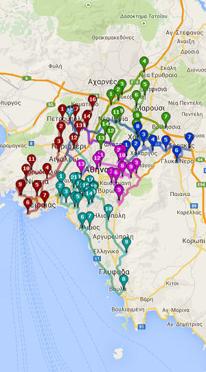
Tailored made features for your business

  • Web interface API.
  • Precise cost management.
  • Measurable and comparable profit by reports.
  • Minimum/maximum delivery date-time can be specified.
  • Minimum/maximum pick-up date-time can be specified.
  • Multi depot, single depot.
  • Multi vehicle .
  • Heterogeneous vehicles, fleet.
  • Time Windows.
  • Maximum route duration .
  • Minimum/maximum non-serving time for vehicles .
  • Available hour list or operational hour list .
  • Split day (scheduling).
  • First all deliveries then, pick-ups.
  • First all pick-ups, then deliveries.

MetaOpt SCFR

Supply Chain Fleet Routing

Support of freight transport

We provide state-of-the-art algorithms in a user friendly environment to solve challenging problems such as multiple loading and unloading points, mixed vehicle fleet, complex load requirements all simultaneously and in narrow time windows.
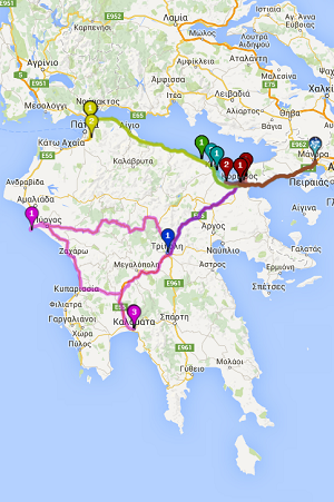
Custom-made solutions for your needs

  • Inbound & Outbound Distribution.
  • Bulk goods transport.
  • Planning for single and multi-day routes.
  • Single- and multi-depot planning.
  • Customer to depot or depot to customer orders.
  • Pickup and delivery orders (customer to customer orders).
  • Cross-docking (two-step transport movements via hubs).
  • Reloading (loading from a depot to a different depot).
  • Connection to tracking device.
  • Tactical and strategic planning.
  • Insight analytics provision through reporting.
  • Pallet Optimization.

MetaOpt FFD

Fast-Food Delivery

A complete suite of tools for fast-food single shops and chains

MetaOpt provides a variety of tools integrated in a single user-friendly environment that covers all steps from strategic design of shops location to the efficient routing of delivery boys.
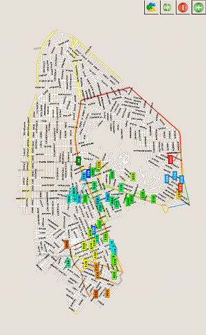
Integrated solution for fast-food delivery

  • Strategic location of new shops.
  • Planning based on population density.
  • Territory planning for chain shops.
  • Optimised shop selection to serve a specific address.
  • Leaflet distribution routing and performance assessment.
  • Impact assessment of different marketing policies.
  • Delivery routing and assessment of performance.

MetaOpt POS

Position of Sales for food industry

An advanced software solution to address food industry needs

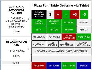
MetaOpt offers a software service that integrates all aspects of ordering, shop distribution, production scheduling and reporting into a user-friendly environment.
Unique features for your business

  • Call-center and in-shop ordering.
  • Web ordering.
  • Integration with routing of delivery boys.
  • Very good approximation of promised time announcement.
  • Advanced reporting.
  • Forecast for raw materials ordering .
  • Forecast of customers' ordering.
  • Optimized workload management.

MetaOpt FT

Fleet Tracking

View real-time information about your drivers and fleet

MetaOpt supports tracking of drivers and fleet, at a glance. The service shows which drivers are currently clocked in, where they are located, what assignments they have queued up, and when they last interacted with the system.

Specific features of fleet tracking

  • Real-time updates regarding the status of field personnel.
  • Driver assignments for new orders.
  • Balanced workloads.
  • Alarm functionality (for overspeeding, geofencing etc.).
  • Acquisition of data (temperature of load container).
  • Monitoring transportation of perishable products.
  • Integrated route planning solutions.
  • Performance assessment of the planned vs actual trip.

MetaOpt MetaIPT

Advanced Image Processing Toolbox

An Application Programming Interface (API) library

MetaOpt Advanced Image Processing Toolbox © (MetaIPT) is an Application Programming Interface (API) library in the form of a Software Developers Kit (SDK). It defines classes and methods to manage images in your own code. You can use it to load/save various file formats, access pixel values, display/transform/filter images, draw primitives (text, faces, curves), compute statistics, manage user interactions on images and much more.

Three distinct processing modules

  • Core Functionality Module
  • Image Processing Module
  • Machine Learning Module

MetaOpt SIS-SDK

Satellite Image Sharpening Software Developers Kit (SIS-SDK)

A powerful system for delivering land surface temperature operationally

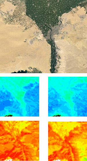
SIS-SDK includes collections of classes, methods and services for the support of the serial procedure for the enhancement of the spatial resolution of thermal infrared images from Earth Observation satellites. MetaOpt SIS-SDK is a set of objects in the form of WCF Service modules.
Operational real time retrieval

  • FTP transfer of raw images from client's ground station.
  • Functions for Image shaRpEning (FIRE).
  • LST calculation for cloud-free pixels.
  • Other relevant data retrieved from internet.
  • Advanced security protocols and encryption.
  • GEOTIFF sharpened LST images.

MetaOpt Maps Toolbox

Mapping Analysis Tools Web service

A state-of-the-art map analysis with numerous applications

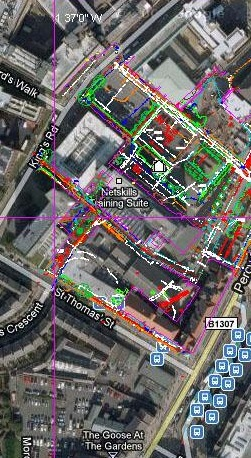
The mathematical network required for supporting routing optimization and shortest path evaluation algorithms is constructed from an ArcGIS ShapeFile in the form of polylines. The network constructed then resides as a persistent object in the Service Memory Space. The Mapping Analysis Tools Web service evaluates several object methods as listed indicatively below.
Coherent integration in your system

  • Shortest Path Algorithm.
  • Dijkstra algorithm for shortest paths.
  • SPair of points.
  • Point to a cloud of points.
  • Two ways undirected graphs.
  • Geocoding for geographical points to postal addresses.
  • Reverse Geocoding for a point location to an address.
  • Road Speeds for different class of roads and vehicles.

MetaOpt FIREMap

FIRE Mapping and Analysis System

The Ultimate Tool for Analyzing Wildfire Growth and Behavior

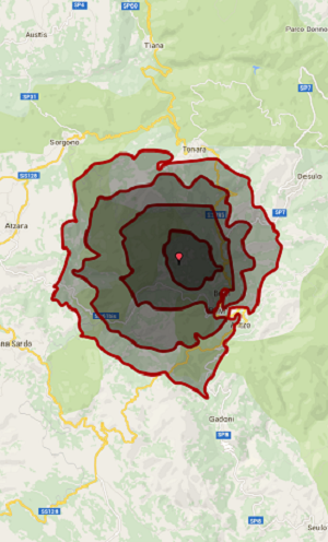
MetaOpt FIREMap is a fire behavior mapping and analysis program that computes potential fire behavior characteristics (spread rate, burnt area, front length etc.) over an entire landscape for constant weather and fuel moisture conditions. The program is intended for users with relevant expertise where the outputs are to be used for making fire and land management decisions. MetaOpt FIREMap runs under Microsoft Windows operating systems and features a graphical user interface.
Seamless integration in your system

  • Multiple ignition points and polygons.
  • Raster maps of potential fire behavior characteristics.
  • Spread rate, flame length, crown fire activity.
  • Inclusion of environmental conditions.
  • Output maps ready to view in MetaOpt.
  • FIREMap, GIS, image or word processor.
  • Spatial information on topography and fuels.
  • Calculation of fire behavior characteristics.
  • Use of obstacles as areas protected by fire fighting forces.
  • Used by Civil Protection, Forest and Park Services.
  • Data for fuels, weather, topography, and wildfire situations.
  • Complimentary to a GIS for spatial raster information.

Connect socialy with us